Pursuant to Decision No. 1412/QD-BTNMT, dated June 12, 2017 of the Ministry of Natural Resources and Environment on approval, the chairing organization, individual in charge and cost estimate of science and technology tasks at the same level. The ministry started implementation in 2017;
Pursuant to the Contract for implementation of the Science and Technology Project No. TNMT.2017.03.02 dated June 16, 2017 between the Ministry of Natural Resources and Environment and the Geophysical Division;
Pursuant to the Decision No. 1922/QD-BTNMT dated July 26, 2019 of the Minister of Natural Resources and Environment on the extension of time for implementing ministerial-level scientific and technological research projects;
Pursuant to Decision No. 822/QD-BTNMT dated April 1, 2020 of the Minister of Natural Resources and Environment on the adjustment of the individual chairperson, main member and extension of time to carry out scientific research projects. Ministry of Science and Technology;
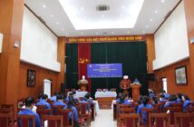
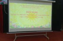
From 2017 to 2020, the Federation of Geophysics and Geophysics has carried out the Ministry-level Science and Technology Research Project: “Researching and building a technological process to identify geological objects, process and combine geophysical documents physics- remote sensing” – Code: TNMT.2017.03.02 led by Master Pham Van Hung.
Objectives of the project: Building a technological process to identify geological objects, combine processing of geophysical documents, and remote sensing.
The project was completed after 39 months of implementation (from July 2017 to September 2020).
The research results have met the stated objectives. Specifically:
– Developed a technological process for processing and analyzing geophysical documents, remote sensing combined with identification of geological objects for geological investigation and mineral assessment by two products: maps. Geological structure and zoning diagram to forecast mineral prospect according to geophysical-remote sensing documents.
– The above technological process has been applied to the geophysical data set, remote sensing in Van Yen region to establish a map of geological structure and a zoning diagram to forecast mineral prospects according to geophysical documents- explore.
– Proven results of mineral prospect prediction by geological survey method on 3 areas. Newly discovered many hydrothermal change zones, many belts of acid to ultramafic composition, granite intrusion blocks related to these changes in the verified areas.
The research results are a step to improve the efficiency and quality of using existing geological documents, geophysical documents and multi-spectral remote sensing image documents for the purposes of geological investigation and mineral assessment. medium to large scale and detail.
The application of this technological process to the geological investigation and assessment of minerals being implemented in major projects today will contribute to speeding up progress, improving the quality and depth of research and forecasting. minerals and minerals hidden deep in Vietnam.
The results of geological research and assessment and discovery of minerals brought about when using this technological process also contribute to improving the economic efficiency of the investment process in geological research, geophysical measurements. and remote sensing photography did before.
Source: Geophysical Division./.


